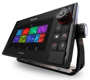
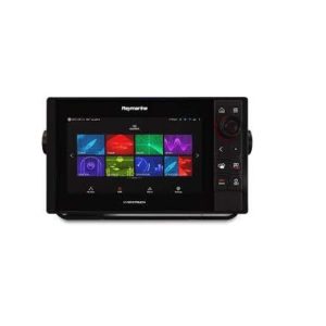
| MODEL | Axiom Pro 12 – Multifunction Chartplotter / Sonar |
GENERAL SPECIFICATIONS
| Display Size | 12.1″ IPS Optically Bonded LCD |
| Display Resolution | 1280 x 800 WXGA |
| Display Type | Multitouch |
| Brightness | 1,200 nits |
| Viewing Angle | Degrees: 88 / 88 / 88 / 88 (Top / Bottom / Left / Right) |
PHYSICAL
| Dimensions | 14.1″ x 9.17″ x 2.56″ (358 x 223 x 65 mm) |
| Weight | 5.4kg (11.90lbs) |
| Mounting | Top, Front, Bracket |
| Waterproof Rating | IPX6 / IPX7 |
| Operating Temp | minus 13deg F to 131deg F (-25deg C to +55deg C) |
| Storage Temp | minus 22deg F to 158deg F (-30deg C to +70deg C) |
| POWER | |
|---|---|
| Voltage | 12V and 24V DC (8 V to 32 DC) |
| Power Consumption (Full brightness) | Axiom Pro 12: ~35W |
SENSORS & PERIPHERALS
| SENSORS | |
|---|---|
| GNSS / GPS | Built-in GNSS Receiver: GPS/GLONASS/Galileo/Beidou – 10Hz 72 Channel | External Accessory: GA150 (A80288) |
| Sonar Type – Built-in | Pro S model – High CHIRP* Pro RVX model – RealVision 3D + 1kW Sonar |
| Sonar Connections | S variant*= 25pin connector used only with CPT-S transducers RVX variant = 25pin RealVision™ type connector + 11 pin 1kW type connector *Pro S can only be used with CPT-S transducers. Requires A80490 adaptor cable. External Sonar – RayNet |
| Sonar Depth | CHIRP Sonar = 900 feet (274 m) DownVision™ = 600 feet (183 m) | SideVision™ = 300 feet (91 m) | RealVision™ 3D = 300 feet (91 m) 1kW = 5,000 feet (1,500 m) |
| External Sonar | Yes – CP100, CP200, CP370, CP470, CP570 via RayNet |
| Radar | Yes – Quantum, Digital, HD Color and Super HD Color Radars |
| AIS | Yes – N2K compatible |
| Autopilot Control | Yes – Evolution Autopilot |
| Thermal Night Vision | Yes – IP or Analogue |
| Video / Camera | 1 x Analogue input (BNC) Up to 10 IP Cameras |
| Weather | GRIB View – Free GRIB viewer and Theyr Ltd Subscription | SiriusXM – N. America Only [Weather features available in future Lighthouse 3 software update] |
| Audio | N2K / *Bluetooth / *SiriusXM Audio [*Available in future Lighthouse 3 software update] |
| Digital Switching | Yes – Empirbus & C-Zone compatible [C-Zone integration available in future Lighthouse 3 software update] |
| Remote Control | RMK-10 (A80438) & RCU-3 (E62351) |
| NAVIGATION | |
|---|---|
| Cartography | Lighthouse, Navionics, *C-MAP Essentials & *C-MAP 4D MAX+ [*C-MAP chart compatibility available in future Lighthouse 3 software update] |
| Waypoint/Routes/Tracks (Wpts/Rts/Trk) | 10,000 wpts / 200 wpt groups / 150 rts – 250 wpt max / 16 tracks – 10,000 max trk pts |
| MEMORY | |
| Internal | 16GB Solid State |
| External | 2 x microSD slots (front) – microSDHC max 32GB NTFS or FAT32 format / microSDXC max 2TB NTFS or FAT32 format (microSD native format of exFAT must be reformatted to NTFS or FAT32) |
| OTHER | |
| Languages | 24 |
| Conformances | NMEA 2000 certification | Europe: 1999/5/EC | Australia and New Zealand: C-Tick, Compliance Level 2 | FCC 47CFR part 15 | Industry Canada RSS210 |


Reviews
There are no reviews yet.